Do you live or work somewhere that could flood in a tsunami? Not sure? That’s OK; San Diegans now have some new maps and easy-reading information that make the risk clear.
On Wednesday, the County’s Office of Emergency Services mailed new maps and information to the more than 30,000 homes and businesses in San Diego County’s potential tsunami flood areas. Using new information developed by state disaster experts, the County for the first time targeted specific addresses that could be at risk in a tsunami.
“If you get one of these brochures, that means your home or business might be affected by a tsunami flood surge,” County OES Director Holly Crawford said. “We’re asking people to take a couple minutes to review the brochure and to keep it where you can refer to it if an approaching tsunami ever forces you to evacuate.”
Each brochure—there are 10 different ones for each of our 10 coastal cities— shows a local map with potential flood areas and evacuation routes to higher ground. View the maps here.
Maps created by the California Office of Emergency Services and the California Geological Survey allowed the County to identify which addresses are at risk in the worst-case tsunami scenarios expected here.
The County worked with representatives from each coastal city and Chapman College Associate Professor Claudine Jaenichen to design the new brochures.
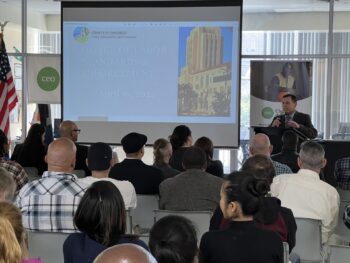
The mailers were unveiled Wednesday at a La Jolla Shores “walkout drill” to coincide with Tsunami Preparedness Week. In the drill, eighth graders from Old Town Academy high-tailed it for higher ground after San Diego lifeguards warned them of an approaching tsunami.
The kids walked quickly up the slope away from the shore to the Scripps Institution of Oceanography. In a real tsunami, they would have wanted to keep walking all the way to UC San Diego at the top of the grade, just to be sure and to leave the area clear for first responders.
San Diego’s 70 miles of coastline could experience a tsunami caused by a faraway earthquake or one close to shore. If a distant quake caused a tsunami, the federal National Tsunami Warning Center in Alaska would warn local officials of the approaching surge. Local officials would notify the public.
If a local quake or undersea landslide produced the tsunami, shaking from the quake itself or the water receding rapidly might be the only warnings.
“If one of these ‘natural warnings’ occurs, it’s important to evacuate beaches, harbors and other low lying areas as soon as possible…don’t wait for someone to tell you to go, just go!” Rick Wilson, a senior engineering geologist with the state’s Geological Survey, said at the event Wednesday.
Moving 100 feet above sea level or two miles inland is recommended in San Diego County. Walking may be faster and safer than driving after a quake when roads could be damaged, or when everyone driving away at once from the coast slows traffic.
Wilson said that large and damaging tsunamis are rare in Southern California. In the last 150 years, 13 tsunamis have been large enough to cause damage or hurt or kill people.
Thursday will mark 50 years since a 9.2 magnitude earthquake near Alaska killed 13 people statewide. More recently, in 2010 and 2011, the tsunamis from earthquakes near Chile and Japan caused more than $100 million in damage to harbors around California, Wilson said. Locally, tsunami surges and strong currents caused flooding and minor damage.
Wilson said we were lucky that low tides here made the rising water less dramatic.
“Next time we may not be as lucky with the tides,” Wilson said.
On Wednesday, as part of the drill at La Jolla, San Diego Lifeguard Lt. John Sandmeyer explained how local first responders would learn of an approaching tsunami and then notify beachgoers and coastal residents. The National Weather Service also tested its local tsunami notification system Wednesday morning.
“This is something government agencies and first responders plan for and practice,” Sandmeyer said. “We want the public to be aware and to prepare too.”
The new maps and information will help the public plan. If you don’t receive a tsunami mailer this week, you most likely do not live or work in a potential tsunami flood area. But spring is here and the shore calls. The new city-specific maps are linked below, and everything you and your family needs to prepare for tsunamis and other disasters is at ReadySanDiego.org.
City maps


